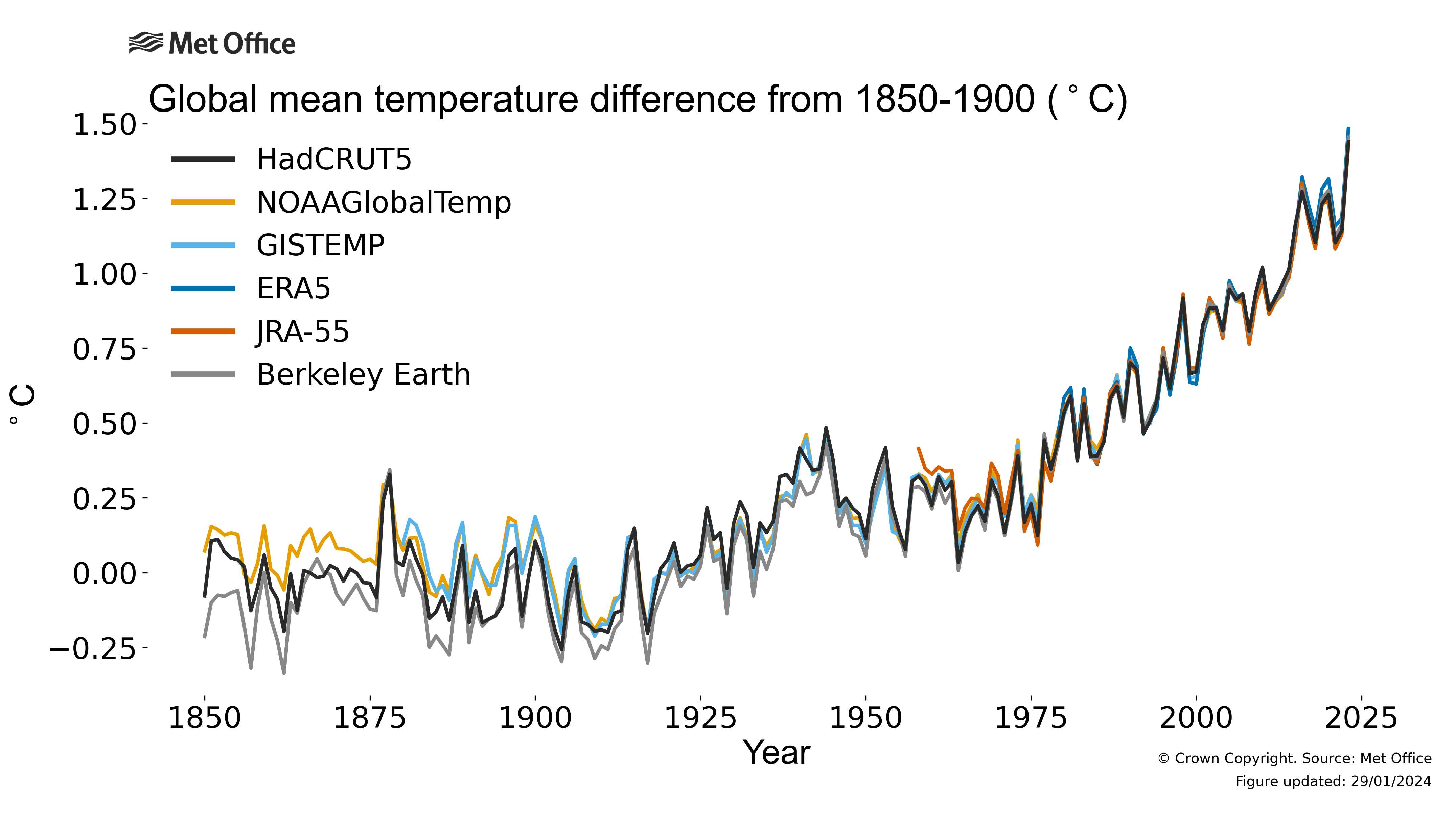
Mondiale temperatuur
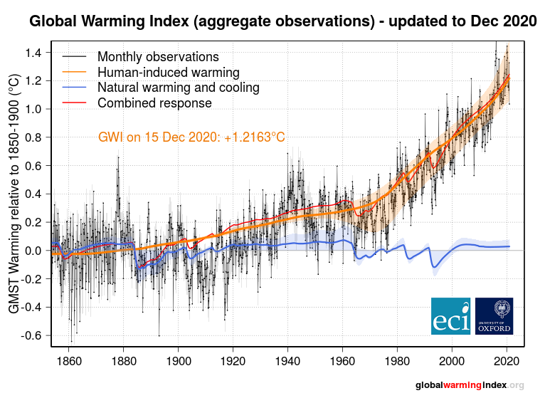
Global Warming Index
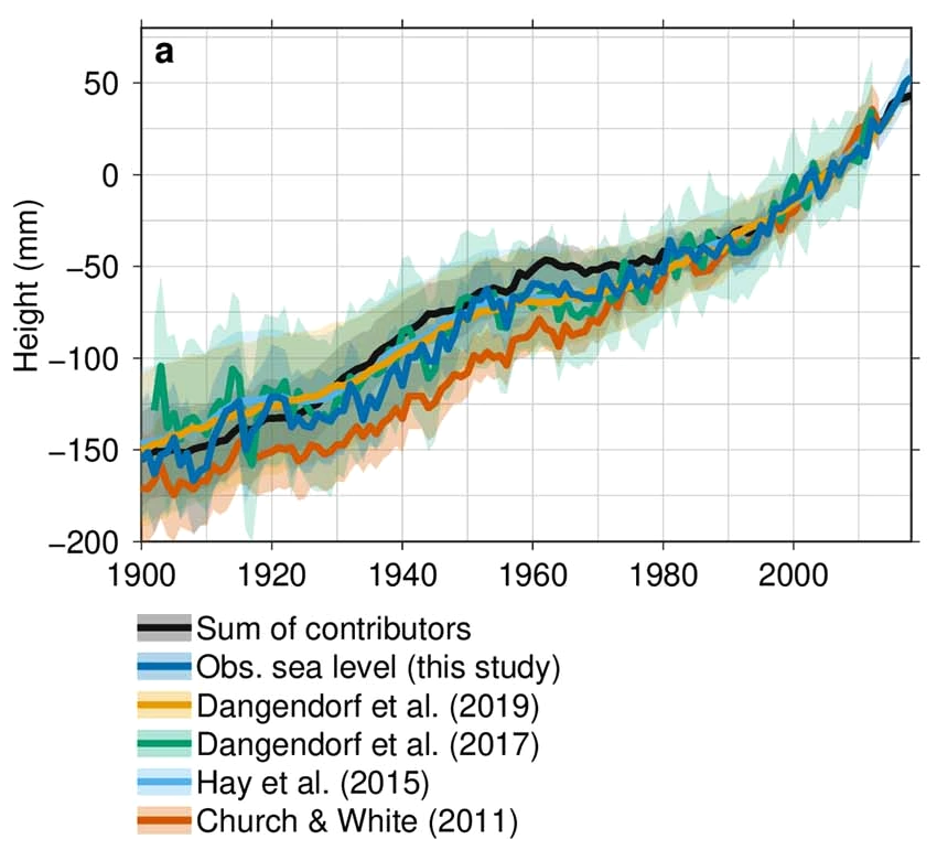
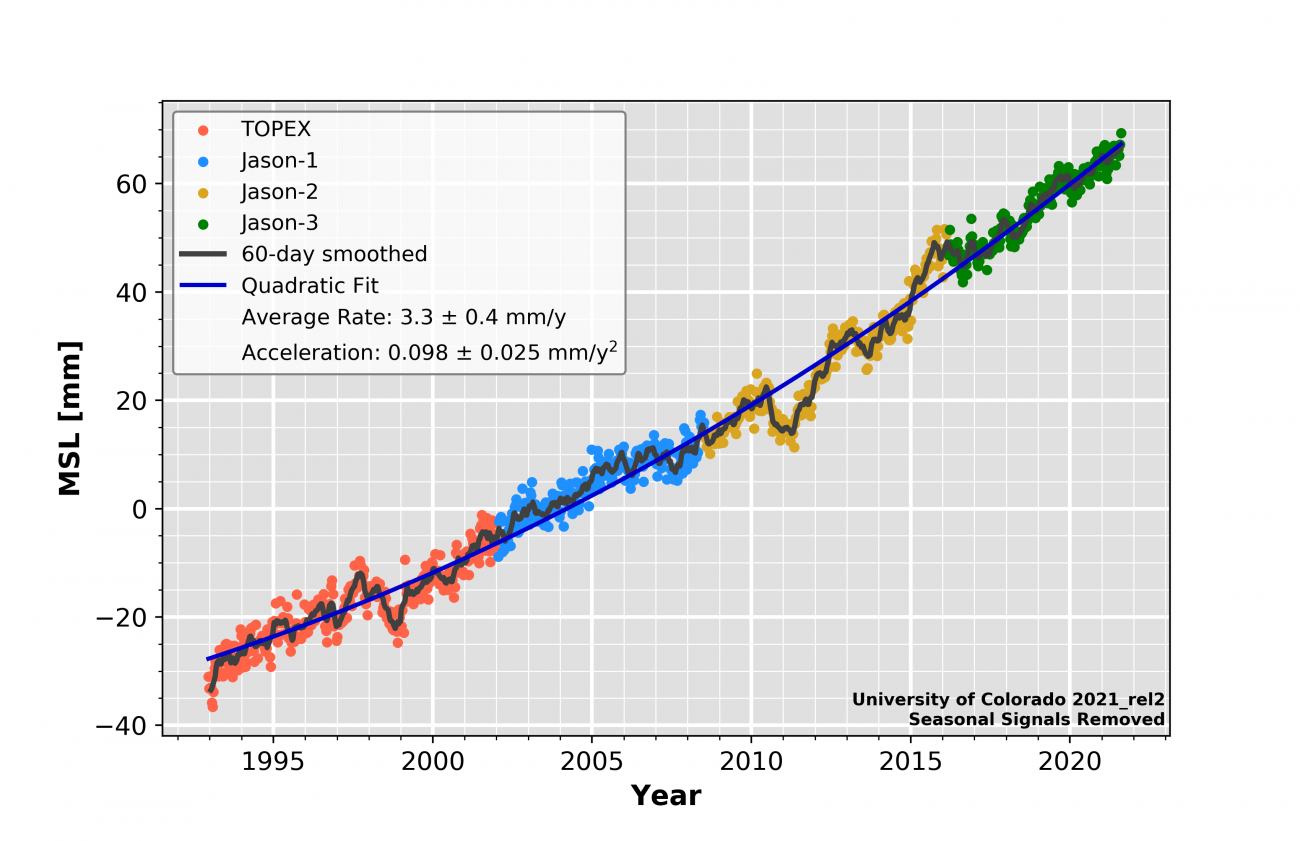
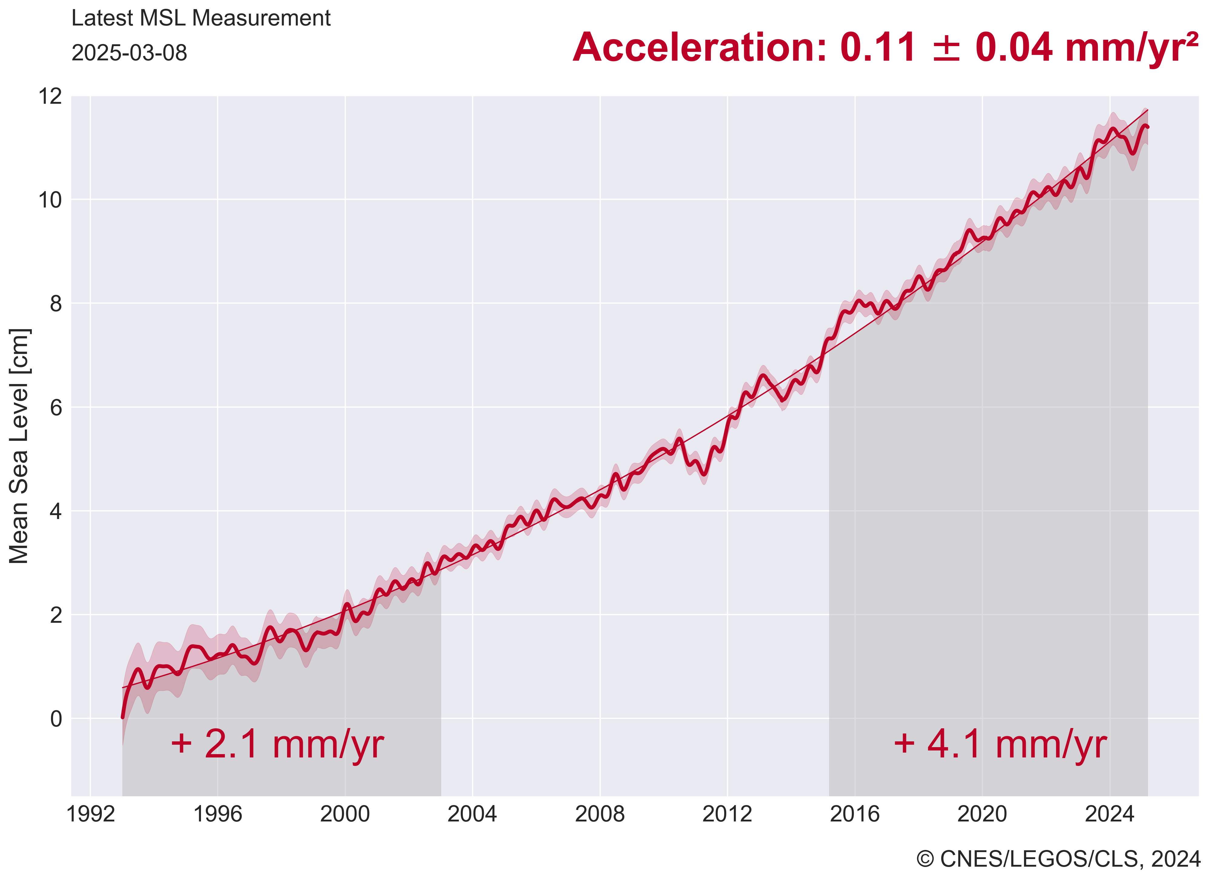
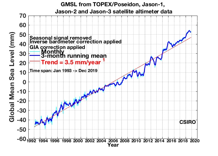
Zeespiegel
Zee-ijs
Sneeuwbedekking
Warmteinhoud oceanen
Broeikasgassen
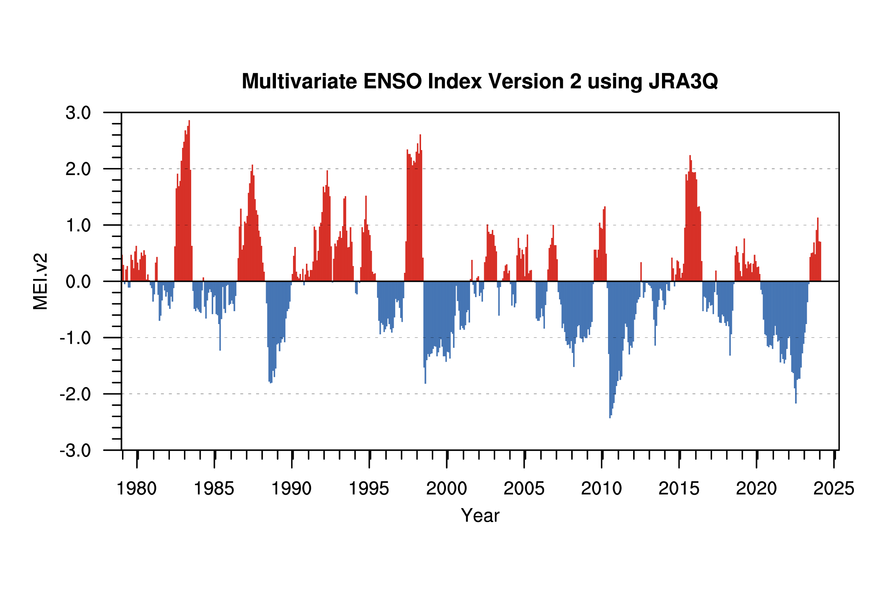
Oscillatie Indices


Datasets oppervlakte temperaturen:
GISS Surface Temperature Analysis (GISTEMP)
Met Office Hadley Centre HadCRUT5
NOAA/NCEI Global Surface Temperature Anomalies
Japan Meteorological Agency (JMA) Global Surface Tempeatures Anomalies
Berkeley Earth Land + Ocean Data
Cowtan & Way Temperature series
Copernicus surface air temperature maps
Datasets satelliet temperaturen:
The University of Alabama in Huntsville (UAH) Global Temperature Report
Remote Sensing Systems (RSS) Upper Air Temperature

Onderzoeksgroepen zeespiegelstijging:
CU Sea Level Research Group (University of Colorado)
Aviso Satellite Altimetry Data Mean Sea Level
CSIRO Sea Level Rise
NOAA/NESDIS/STAR Laboratory for Satellite Altimetry / Sea Level Rise
NASA – Vital Signs of the Planet – Sea Level
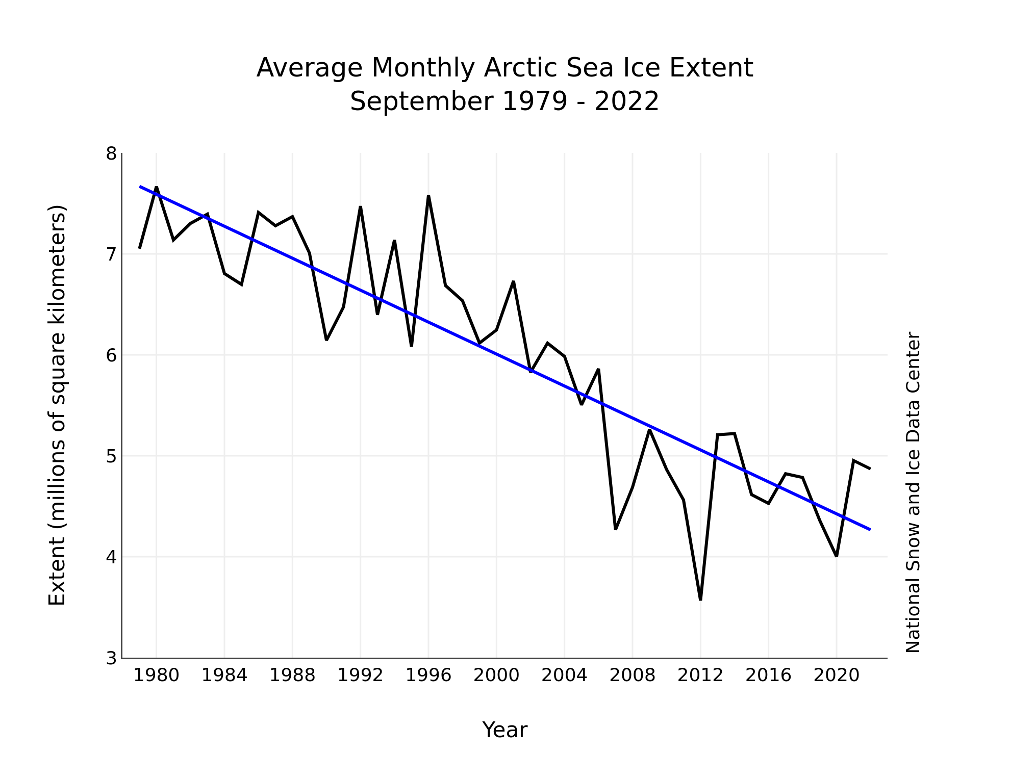


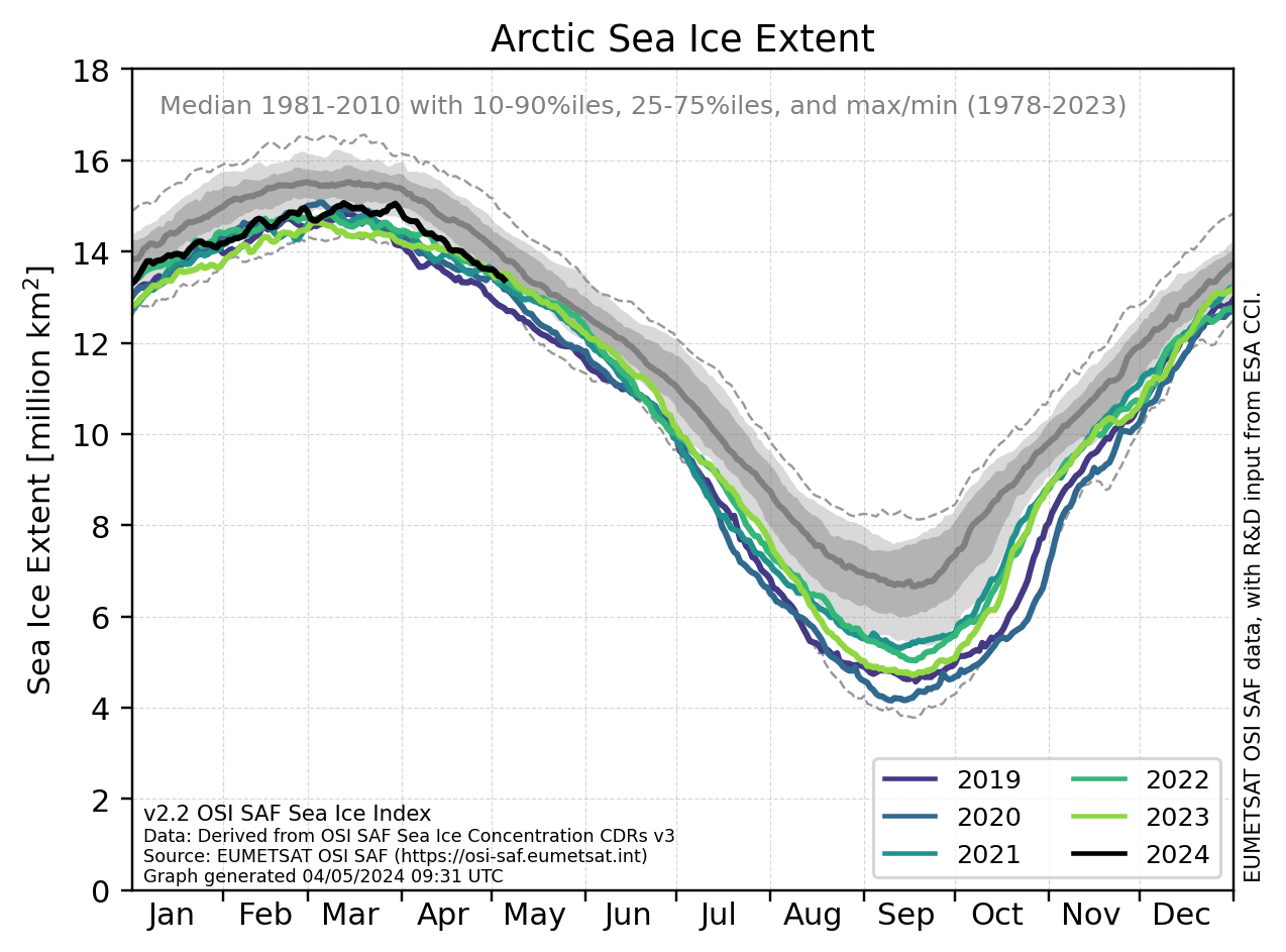
Informatie zee-ijs:
NSIDC Arctic Sea Ice New and Analysis
Danish Meteorological Institute (DMI) Arctic Sea Ice Extent
Arctic data archive system (ADS)
The Cryosphere Today (University of Illinois)
Arctic Sea Ice Blog

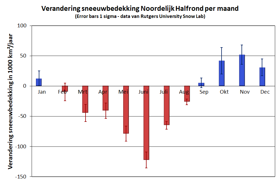
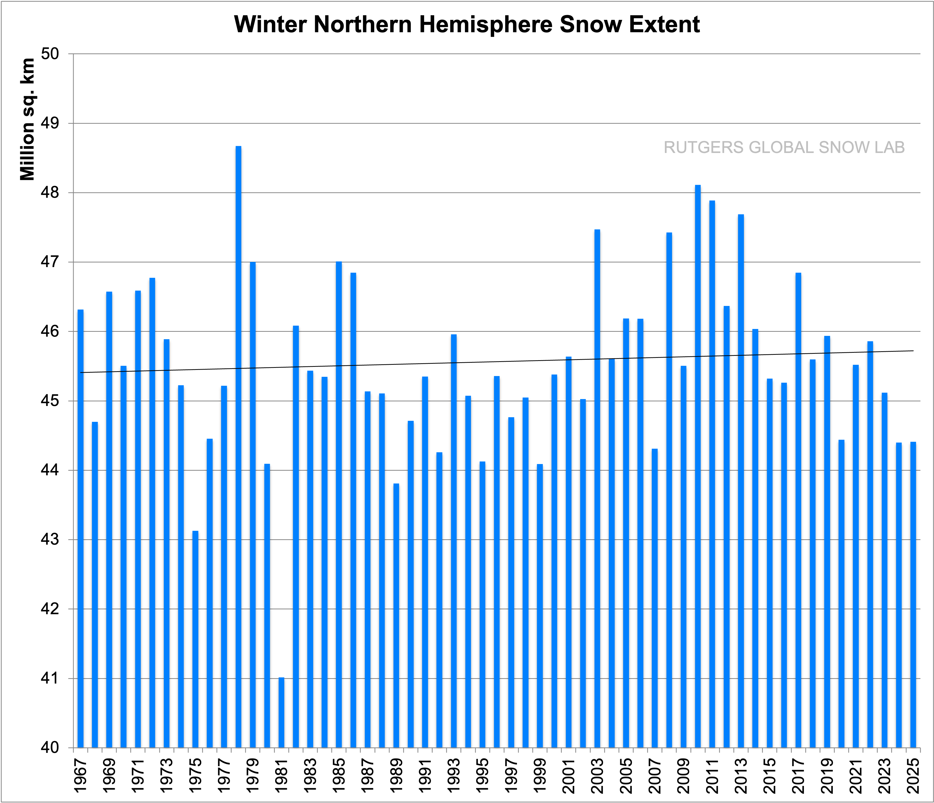
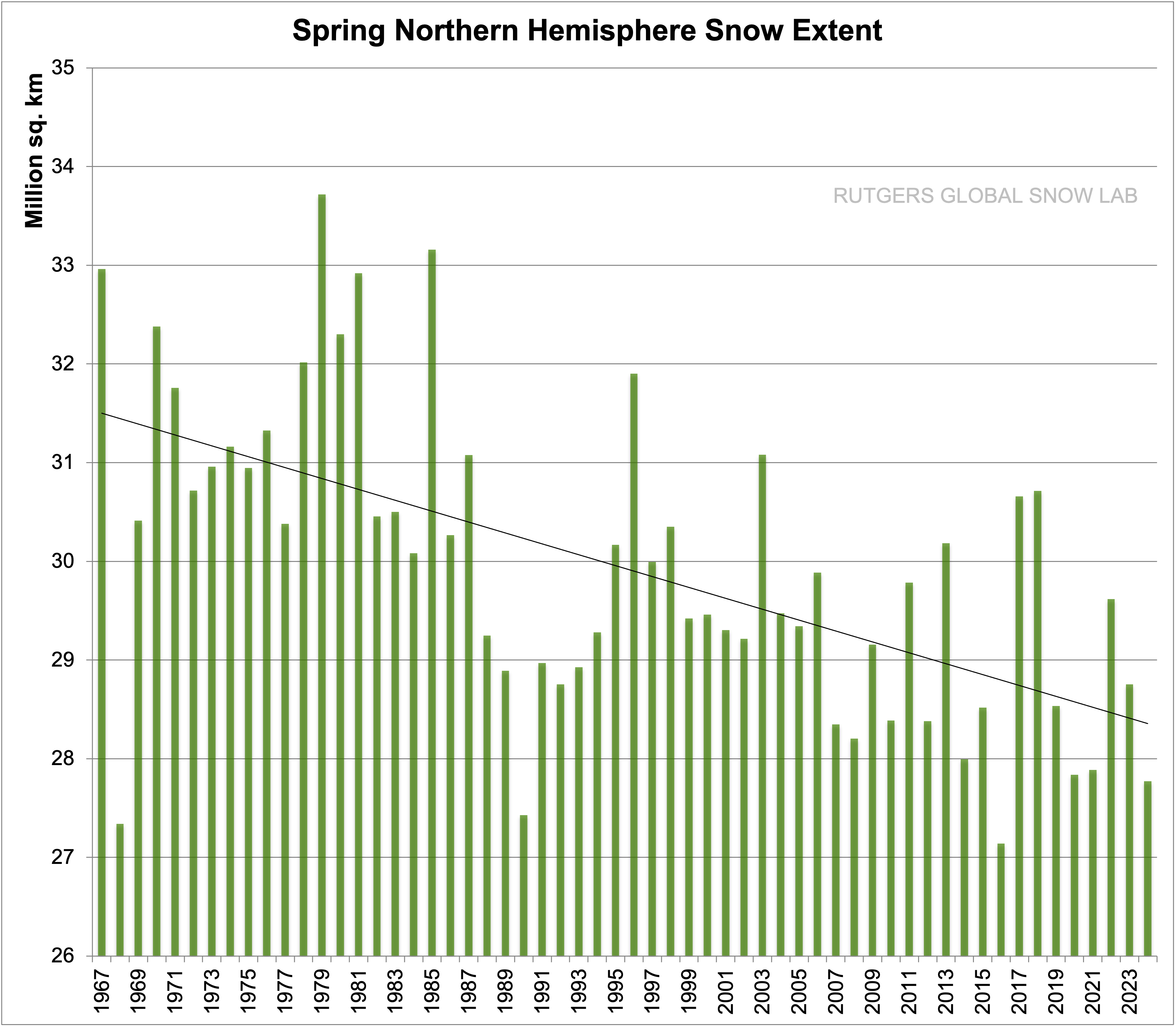
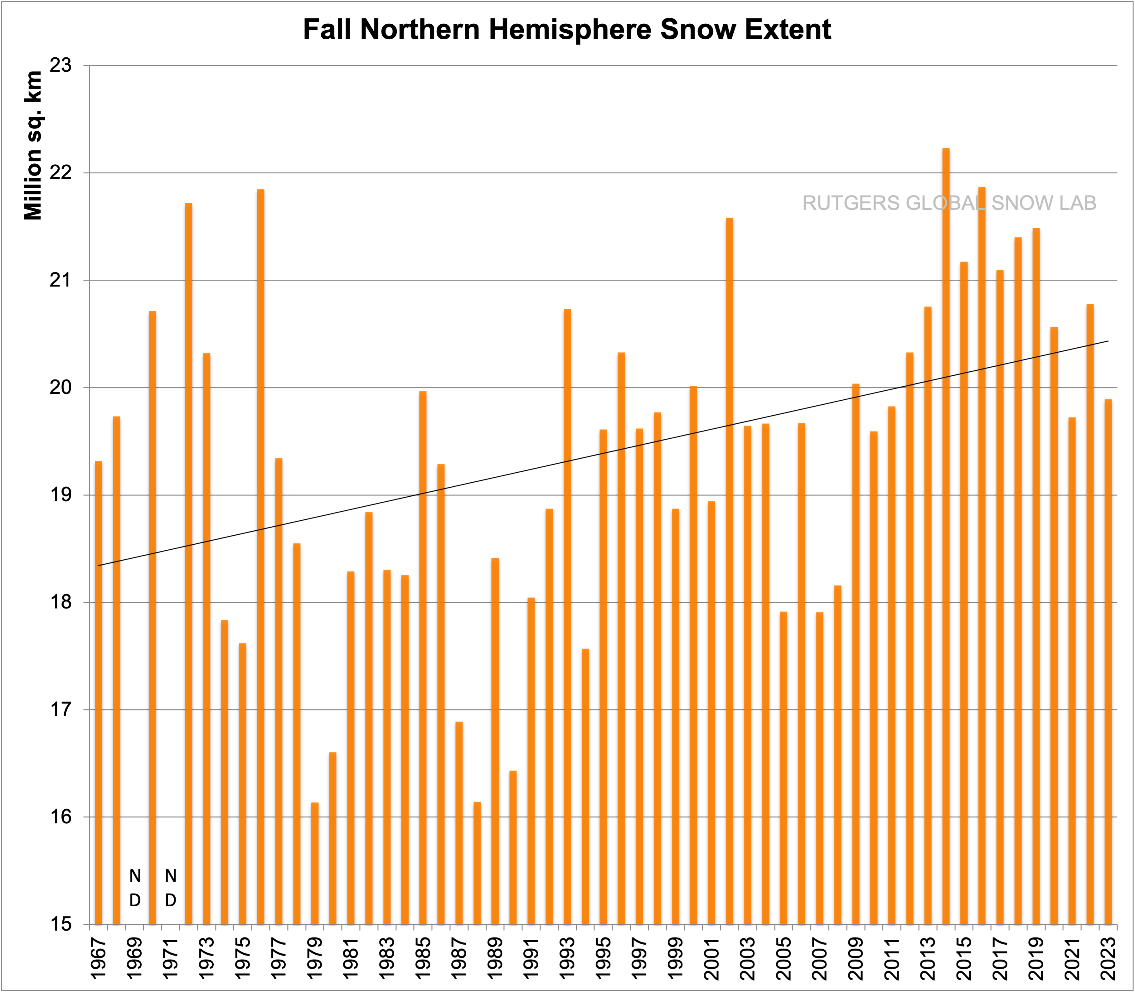
Info sneeuwbedekking:
Rutgers University Global Snow Lab
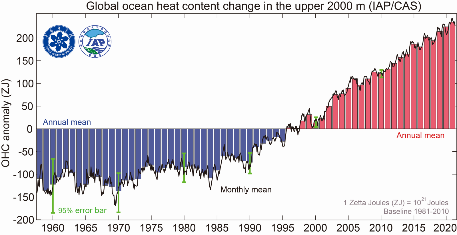
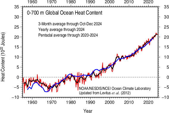
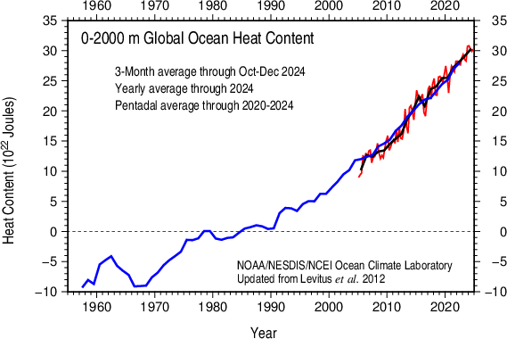
NOAA/NODC Global Ocean Heat and Salt Content


Informatie broeikasgas concentraties:
Scripps Institution of Oceanography – The Keeling Curve
NOAA’s Annual Greenhouse Gas Index
CO2Now.org

Links naar diverse indices:
NOAA Multivariate ENSO Index (MEI)
NOAA Weekly ENSO Update
Australian Bureau of Meteorology ENSO Wrap-Up
KNMI Climate Explorer – Monthly Climate Indices
The Pacific Decadal Oscillation (PDO) – University of Washington
NOAA Climate Indices: Monthly Atmospheric and Ocean Time Series